
QGIS plugin for plotting Philippine land titles from technical descriptions
Title Plotter is a QGIS plugin that allows users to draw land parcel polygons using bearing and distance technical descriptions found in Philippine land titles. It provides a visual and interactive tool for surveyors, mappers, and land professionals to convert textual property descriptions into geospatial geometries, preview them, and plot them directly on the map canvas.
| Version | QGIS >= | QGIS <= | Downloads | Maintainer | Date |
|---|---|---|---|---|---|
| 1.0.0 | 3.0.0 | 3.99.0 | 102 | isaacenage | May 02, 2025 – 1:30 PM |
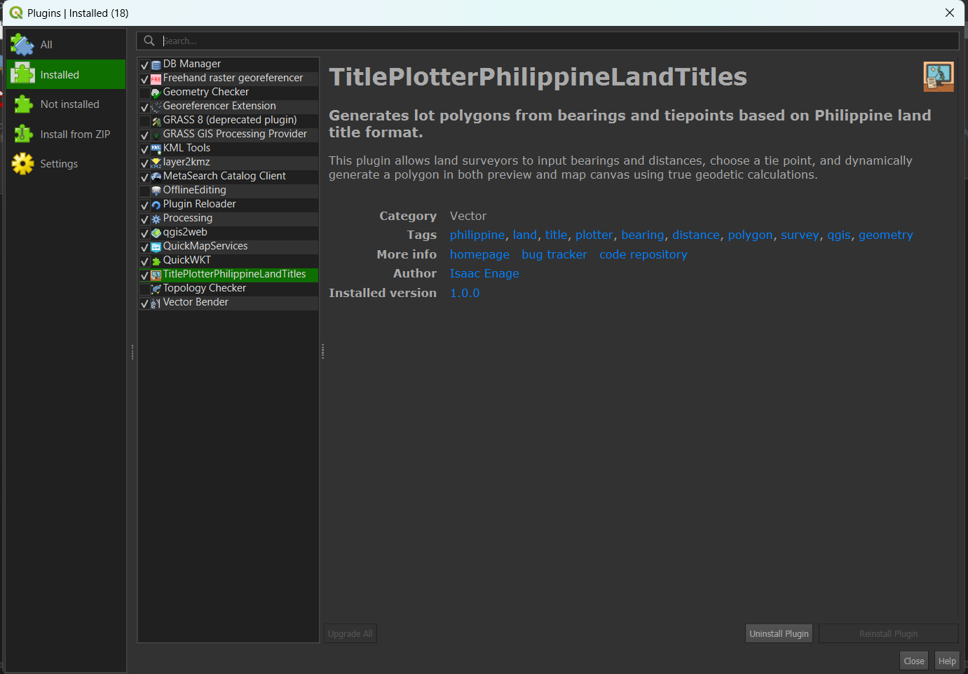
Download the plugin ZIP from this website. Open QGIS and go to Plugins > Manage and Install Plugins > Install from ZIP. After installing, you will see the plugin listed and activated like below:
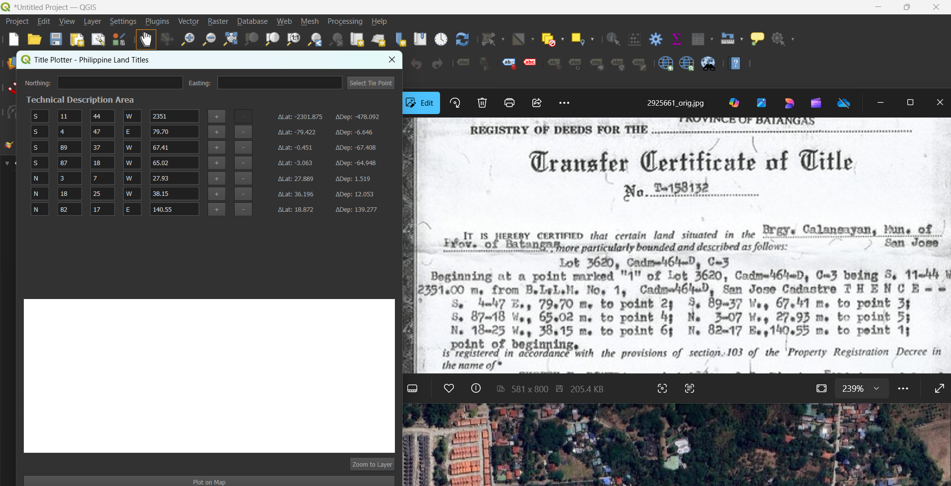
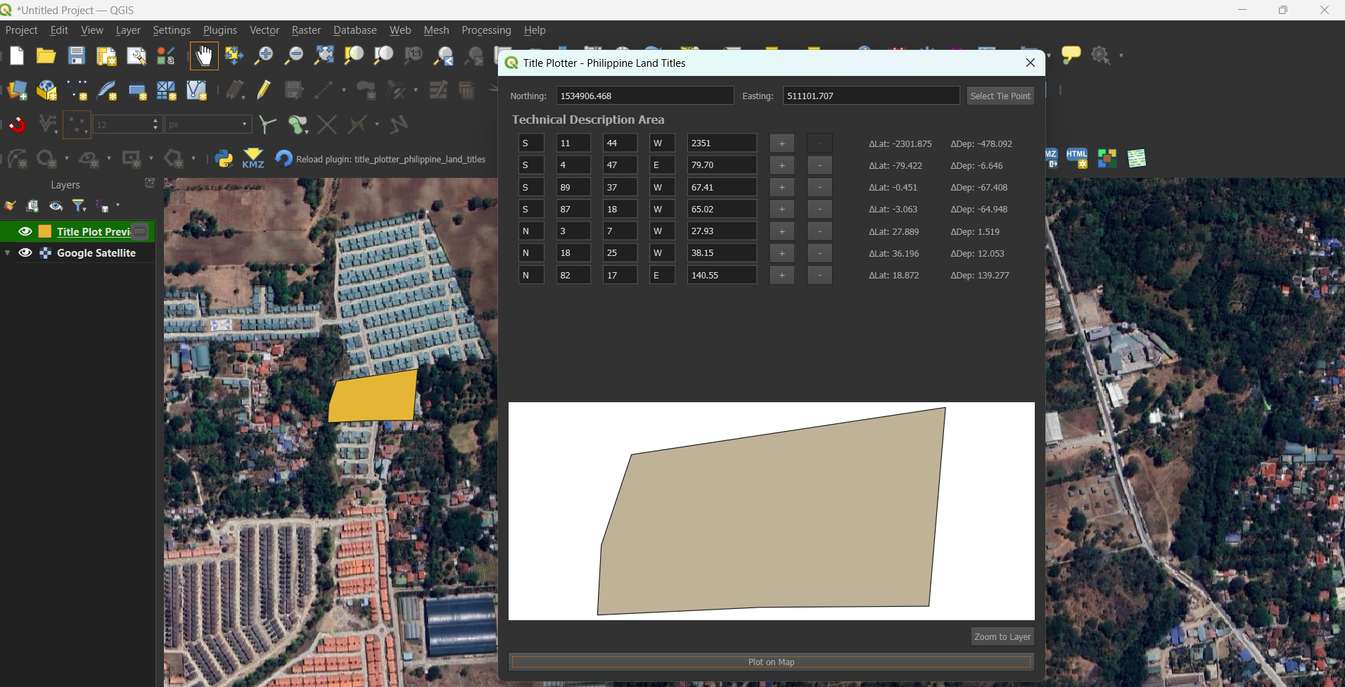
Open the plugin panel. Manually input the technical description of the title in the input boxes using the format:
N XX XX E DISTANCE
Example: N 57 32 E - 4479.73
See input example below:
After entering all bearings and distances, click Select Tie Point at the upper right. This opens a blank window where you can search a local database of tie points (based on what has been acquired so far).
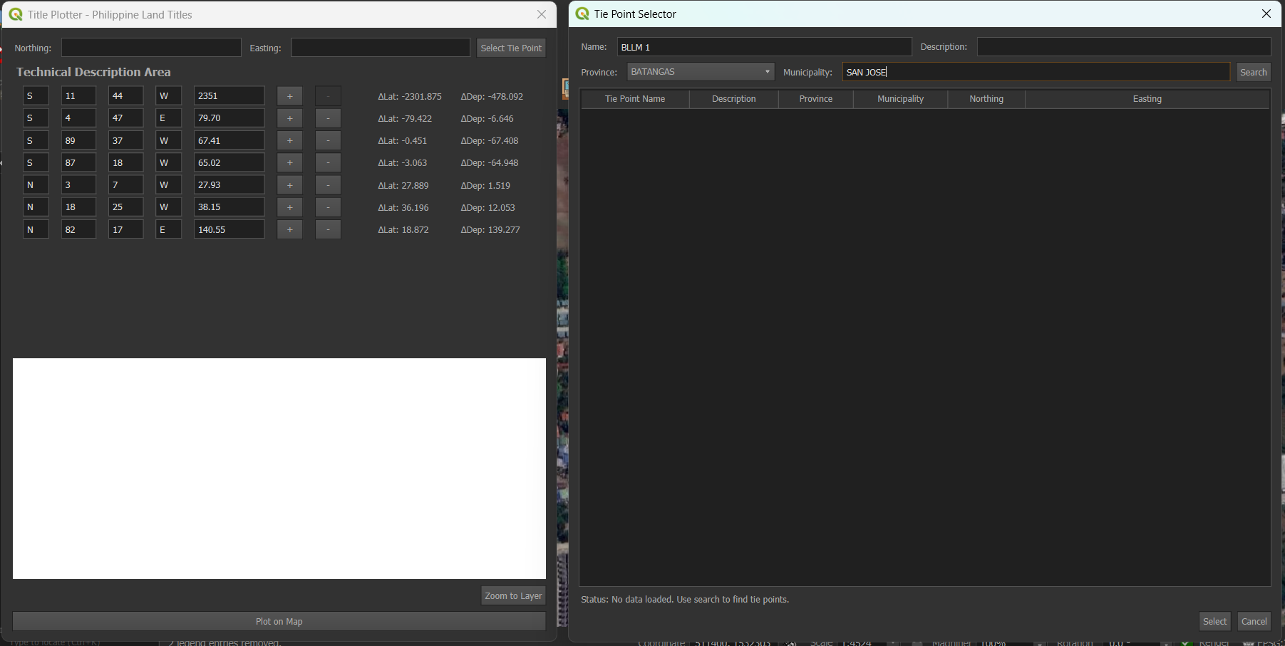
You'll need to fill in the Tie Point Name, Municipality, and Province. Always refer to the title document (TCT) for these details. Once selected, click Select and the Northing and Easting will automatically populate in the main dialogue.
Once all fields are filled, the preview panel will automatically generate a polygon outline of the lot. This helps verify correctness before plotting:
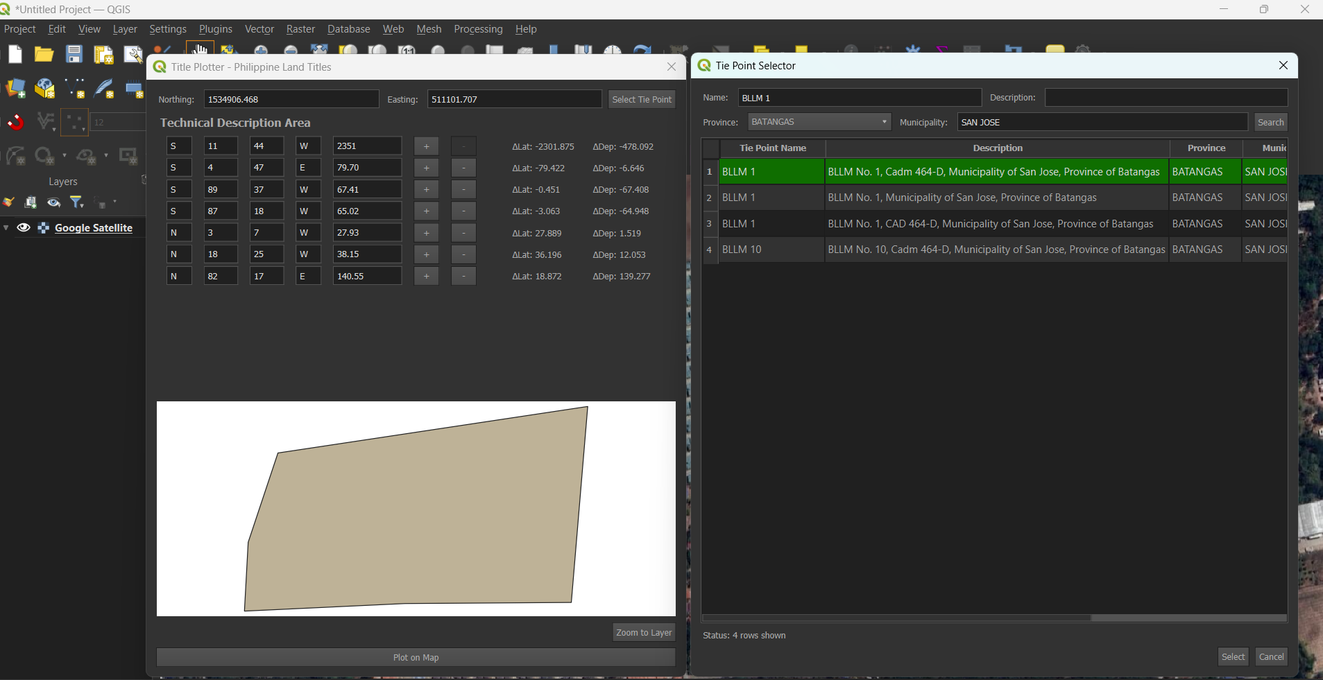
Click the Plot button to render the polygon directly on the QGIS map canvas.
EPSG:4326 (WGS 84) as your projection. Use a projected CRS such as:
The plugin includes an OCR (Optical Character Recognition) feature to automatically extract technical descriptions from scanned TCT documents. Here's how to use it:
pytesseract to automatically extract bearings and distances.This guide walks you through enabling and using the TCT OCR feature in the Title Plotter - Philippine Land Titles QGIS plugin. This feature lets you upload a scanned copy or screenshot of a land title's technical description, and automatically extracts the bearings and distances for plotting—no need to type them manually.
Tesseract is the engine used to recognize text from images. Follow these steps to install it:
.exe file under "Tesseract at UB Mannheim".C:\Program Files\Tesseract-OCR
Tesseract requires support libraries like pytesseract, Pillow, and opencv-python.
"C:\OSGeo4W\apps\Python312\python.exe" -m pip install pytesseract pillow opencv-python numpy
In QGIS:
import pytesseract
from PIL import Image
import cv2
import numpy as np
If no errors appear, you're good to go.
In the OCR window:
Beginning at a point marked...
N 45 30 E - 100.50
S 12 00 W - 98.75
Extracted values are filled automatically into the input boxes.
C:\Program Files\Tesseract-OCRFor updates or issues:
https://github.com/isaacenage/TitlePlotterPH
© . All rights reserved by Zaxus - Zac's Nexus.
Recent Comments